OUP Walk: Cleveland Heights and “Borax” Smith


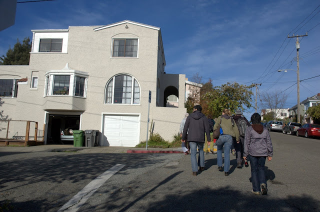
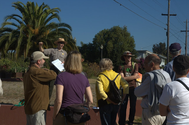
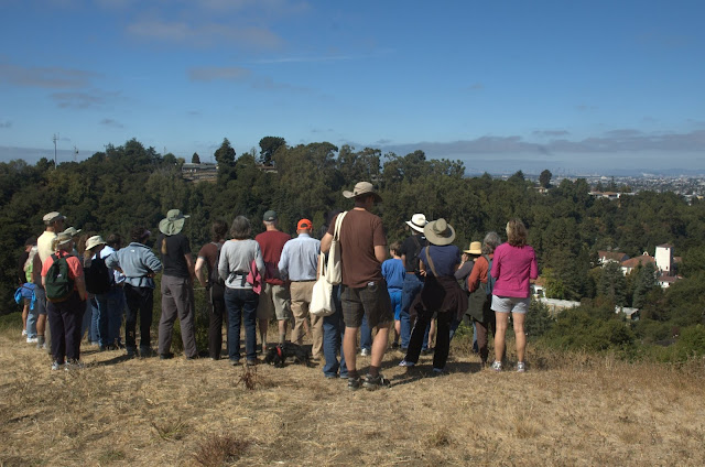
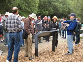
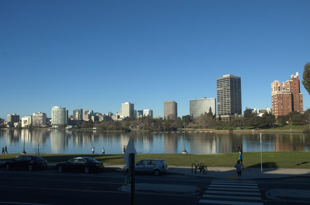
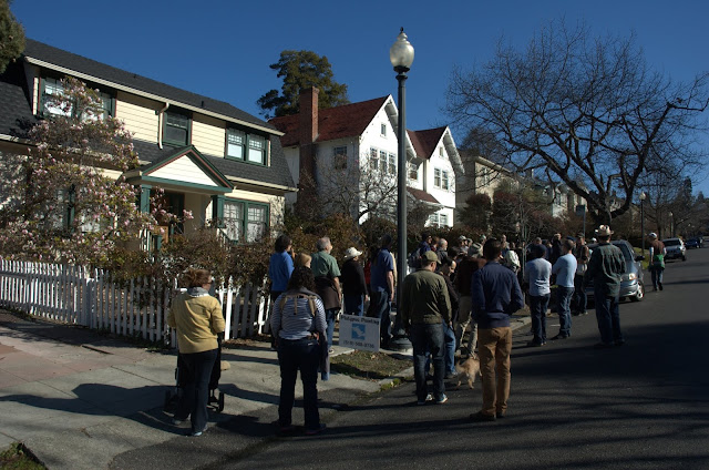
Saturday we had an amazing turnout for the monthly Oakland Urban Paths walk. At least 65 people and 7 dogs joined us for a walk exploring Cleveland Heights and the site of the former “Borax” Smith estate. It was a chilly but beautiful morning, and the view over Lake Merritt was breathtaking.

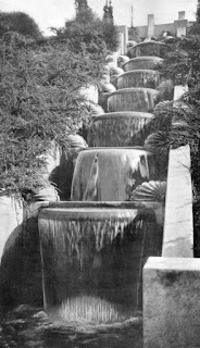
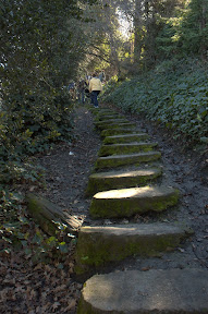
We started the walk at the Cleveland Cascade. Designed by landscape architect Howard Gilkey in the 1920s, the cascade had 3 levels of 7 steps each. Each step had a bowl that made a curved sheet of pouring water. At each side were shell-shaped brackets, behind which were lights running through the colors of the rainbow. Over time, the cascade and nearby steps became rundown and overgrown. Barbara Newcombe was part of the original group that helped rediscover and uncover the stairs back in 2004, and was there on Saturday working on the stairs. Since 2004, the Friends group has cleaned up and maintained the stairs, installed new railings and LED lighting, and created new fixtures that will be installed when enough money has been raised. These days the stairs are heavily used, by people walking between Cleveland Heights and Lake Merritt, by people exercising, or just looking to get a different view of the lake. Read more about the Cleveland Cascade from in last year’s OUP: Jane’s Walk.

We walked up the steps along the Cascade and around to Cleveland Street. Area maps show a right of way between the top of the Cascade and Cleveland Street, but there are no signs that steps were ever built there. The question of “what neighborhood is this?” led to questions about the boundaries of Cleveland Heights, other names for smaller areas within it like Haddon Hill, and the general question of “what’s a neighborhood?” The main take-away is that neighborhood boundaries are fuzzy at best. Even though my Oakland Neighborhoods map has clear boundaries, the reality is that it depends on who you ask.

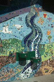
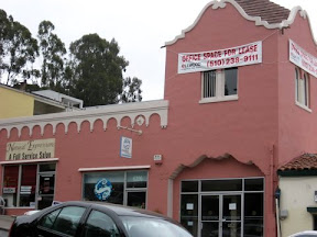
Along our way east, we admired some of the beautiful houses and apartment buildings, pieces of street art large and small, and of course I was checking out sidewalk stamps. They can give clues about the age of a neighborhood.


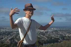
We crossed over Park Boulevard into Ivy Hill and Bella Vista, which is where the “Borax” Smith estate was. Francis Marion “Borax” Smith made his fortune in borax mining, and coined the slogan “20 mule team borax” which is still in use today. Smith is better known in Oakland for creating the Key System of streetcars. He and his business partner Frank Havens created the Realty Syndicate and bought large pieces of land then sold smaller pieces for development. To get people out to see the real estate, Smith bought up various streetcar lines and combined them into what became known as the Key System. To encourage people to visit, destination resorts like the Claremont Hotel were built. Traces of the Key System can be found all over Oakland, sometimes in subtle ways. Sometimes they’re still there, like the Claremont Hotel, and the Realty Syndicate building at 1440 Broadway. We were fortunate to be joined by Dorothy Lazard, head of the Oakland History Room at the main Oakland Public Library who told us more information as we went along.

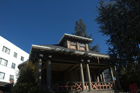
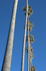
Further along, we saw another wayfinding mark: a row of palm trees. They mark one edge of the Smith estate, which was known as Arbor Villa. The house itself was called Oak Hall, and was extravagant. It had 42 rooms, including 15 bedrooms; a ballroom; a bowling alley including a ball return; an organ with 18 or more ceiling-height pipes; an attached conservatory; and even a miniature borax mine. The 50-acre grounds were equally impressive, with a 5-story tower with an observatory; a large lily pond; a paddock where deer were kept; stables; several greenhouses; and a variety of guest houses and other structures.

I was inspired by what I’d learned on the Oakland Heritage Alliance “Borax” Smith tour and the bits and pieces I found online preparing to lead Saturday’s walk. So Sunday afternoon I joined other like-minded Oaklanders at the Oakland History Room and did more research on Arbor Villa. I’ve started an Oakland Wiki page about Arbor Villa, and will be updating it as time permits. Other things I learned about where the existence of an archery range, a small man-made cave called “The Grotto”, a cattery(!), and various gardens. Because one information source were the Sanborn Maps, which were created to estimate fire insurance rates, I also found other details, like the observatory tower contained a 10,000 gallon water tank.

We crossed back over Park Boulevard, but we weren’t done with the Smiths yet. Frank and his wife Mary donated money for the building of the El Campanil at Mills College. Mary was inspired to help children. After reading Benjamin Farjeon’s Blade O’ Grass about orphans in London, she took in various orphan children. Frank gave 34 acres of land across from Arbor Villa, and endowed the Mary R. Smith Trust for her to start a “home for friendless girls”, AKA orphans. “The Lodge” (a home that’s still there) at the center served as the intake office. Eventually 13 cottages were constructed for the girls to live in, and each cottage was given an endowment. A larger structure called the Home Club was constructed where Oakland High School is now, and served as a central clubhouse for different activities.

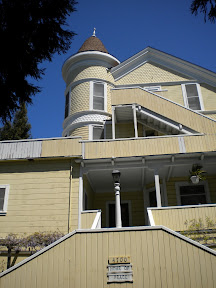
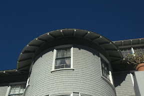
Along Park there is stairway that goes up the hill between several apartment buildings. Although it was a public right-of-way, it’s no longer publicly accessible. The stairs are also where a long, arbor-covered stairway went up the hill to the Home Club. A little further along Park is large home, which was one of the 13 cottages and was designed by Julia Morgan. Some of the other cottages still exist, and were designed by such notable architects as Bernard Maybeck and George W. Flick.

Our journey back took us across Haddon Hill, past more beautiful homes, apartments, and church buildings. Of particular note was a large home that was owned by noted industrialist Henry J. Kaiser. He started Kaiser Aluminum, Kaiser Shipyards (which built tons of ships during WWII) and what eventually became Kaiser Permanente, the first HMO. I’ve heard that Franklin Delano Roosevelt stayed there at least once while in the SF Bay Area.

Across the street is a stairway at the end of Haddon Road. As recently as 30 years ago, it was open and accessible. Now it’s blocked off by fences, and overgrown by trees and other plants. While it’s sad to see public stairways cut off, but it’s also understandable when an area wants to restrict easy access from some streets. It was doubtless very different before the MacArthur Freeway (I-580) was built, but now that section of MacArthur feels somewhat orphaned because it’s cut off by the freeway.

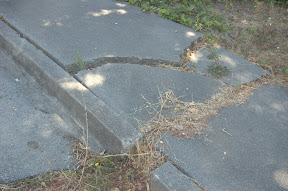
Our final stairway took us down from Merritt Avenue down to Beacon Street. It’s another historical staircase, and beautifully if somewhat impractically designed. Each section of stairs has a different design, whether curved, bay-shaped, or straight. They’re also smaller than would be permitted under current building codes. Fortunately a neighbor at the top of the stairs warned us that several of the steps at the bottom were broken, so we proceeded down with extra caution. I reported the problem with SeeClickFix, an online system for reporting potholes, vandalism, and other problems for the Public Works to address. If you’d like to help fix the problem, click here and vote.

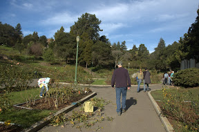
More pictures from Saturdays walk:

Special thanks to Chris Kidd for the use of some his photos. I’ve discovered that leading a walk (particularly a large one) makes it harder to take pictures of the walk. If you have pictures of the walk you’d like to share, let me know.

Those of you who had difficulty hearing me talk (which is probably all of you at some point) will be happy to know we’re going to use your generous tips to invest in a portable sound system so large groups can hear better.

Related links:

Thanks to everyone who showed up! Hope to see you at the next Oakland Urban Paths walk, which will be the second Saturday, February 9th. The location is yet to be determined, but it’ll be in Oakland and it’ll be fun!

OUP Walk: Walk and Shop III


Saturday there was a small but enthusiastic group for the third annual Oakland Urban Paths ‘Walk and Shop’. We started on Lakeshore in Mandana Plaza and had beautiful weather for our walk.

We walked up the hill to look out over Lake Merritt past the Grand Lake Theater sign, and talked a bit about signs and urban paths. Some paths have street-like signs, some have other signs, but many have no signage at all. Since our walk was going to take us from Oakland into Piedmont and back, I told people about how to tell what city you’re in based on the style of street signs.

We crossed over Grand Avenue and up some stairs then down Jean Street to the Morcom Rose Garden. It’s named for Fred Morcom, the mayor of Oakland in the early 1930s who led the creation of the garden. The Friends of the Morcom Rose Garden, better known as the “Deadheaders”, were out in full force working on the roses. While it’s a city of Oakland park, volunteers do a lot of the maintenance. They’re out every second Saturday if you want to join them.

Then we walked through the park to Piedmont, where Paul pointed out the different street signs when we were in Piedmont. Never straying far from the Oakland border, we headed towards the Mountain View Cemetery. I told people about the tours there and the Oakland and California history there is to learn about. Docents at the cemetery lead general tours every 2nd Saturday and tours focused on different topics every 4th Saturday.

From there we were officially on our own for a while, to give people a chance to shop and wander at their own pace. I browsed a few shops, then stopped for a snack at La Farine bakery.

After that we met up at the Key Route Plaza. It’s named that because it used be a car barn for the Key Route. There’s a plaque and a lovely mural to commemorate the Key Route trains that used to run through there then up Piedmont Avenue. The mural is by artist Rocky Baird, who also painted the nearby mural on the side of Gaylord’s Coffee Shop. It features Key Route train #159, which last left the station at 6:45pm on April 19th, 1958. The mural is full of meanings, starting with the obvious figure of F.M. “Borax” Smith who created the Key Route to get people out to see and hopefully purchase his real estate. But the people pictured riding in car #159 were some of the donors, and there are other figures of note through the image as well. Read more at Oaktown Art and on SFGate.com.

We followed and crossed Glen Echo Creek towards downtown. Then it was up more stairs to Oak Park, more stairs and walkways past Harrison and Oakland Avenue, into Adams Point. Past some graffiti and a gnome or two, we crossed over I-580 and walked to the Grand Lake Theater. From there people headed to the Farmers Market, shopping on Grand Avenue or Lakeshore, or back towards home.

Another good walk, with lots of interesting bits and pieces to learn about Oakland and its history. Thanks to everyone who came out for it!

Lots more pictures from the walk:

Links to some of the things I mentioned:

OUP Walk: Rockridge Ramble

On November 10th over 30 walkers and three dogs convened for the Oakland Urban Paths Rockridge Ramble. The 4-mile walk benefited from a post rain glow of sun and a hardy group of walkers well suited for the vigorous outing. The route covered 12 stair/pathway runs of varying styles and conditions and a pedestrian overcrossing. Walkers had a chance to appreciate pathways with and without wayfinding signs. Other memorable features of the walk included great views, a variety of street lamp styles, vacant lots (gap tooth reminders of the ’91 Berkeley Oakland Hills fire), and a diversity of post-fire architecture. All along the way, curious neighbors who asked what we are doing nodded and smiled knowingly when we told them we were checking out the stairs.

Check out our route below:
Rockridge Ramble at EveryTrail

The walk started at the recently refurbished Rockridge BART Plaza. To start we ducked underneath SR 24 and headed east along Miles. The route was designed to give the group an up close look at the underbelly of SR 24 and gain a further appreciation of the tranquility of the neighborhoods we would soon encounter.

Crossing over Boadway via pedestrian bridge, we were able to spy a small park between Brodway and the freeway with a marker for Byron Rumford. Mr. Rumford was a local politician and African American civic leader, and a member of the CA legislature from 1948-1966. Highway 24 is the Rumford Freeway named in his honor. You can learn more about him on the City of Oakland’s New Era, New Politics tour walking tour.

As the group climbed and plunged into the bends and folds of Rockridge, we were able to appreciate the retrofitted handrails at Brookside Lane.

At the top of Brookside Lane, the vegetation and housing are distinctly post-fire. When descending the lower run of Chaumont Path south of Buena Vista we had a chance to take a printed copy of poetry from the poetry steps, tended to by a caring neighbor. At the bottom of those same steps we met a long-time resident who told us about the day of the hills fire and how the winds blew in a favorable direction to spare his house.

The intersection of Romany and Golden Gate is interesting for a couple of reasons.

  1. While currently signed as Romany and Golden Gate, the sidewalk is stamped with two totally different street names.
  2. There are two very unique street lamp styles, in very close proximity. On this walk there were a total of three unique street lamp styles.

We wound along the pleasantly shady sidewalk of Romany and crossed the four-point intersection of Romany and Cross for our final bits of climbing. The Locarno Path is always fun to walk. It’s double-wide with balustrades and makes you feel grand as you get ready for the grand view on Alpine.

At the top of the Locarno Path on Apline, I was told by one of our walkers that we were indeed near the fabled Rockridge Rock. The exact location of said rock has been a topic of discussion on Andrew Alden’s blog.

We completed the ramble by descending the Margardio steps that were refurbished by the City of Oakland in 2010. On those stairs a couple of years ago, I had the chance to meet the owner of the adjacent house who apologized for contributing to the previous stairs demise. He told me that as a boy, his dad asked him to pull out a young tree growing near the stairs. He told his dad he had done this chore, but hadn’t and years later the mature tree would grow to uproot the stairs and landing.

Thanks to all our happy walkers, we’re looking forward to closing out this year’s walking tours with you next month on our Walk and Shop III.


OUP walk: Anza Trail


Earlier this month was a special Oakland Urban Paths walk put on in conjunction with the National Park Service. The tour featured the Juan Bautista de Anza trail, the route taken by some of the first European settlers in California. In 1775-1776, Lt. Colonel Anza of the Spanish army led more than 240 men, women and children 1,200 miles from what is now Mexico to Alta California here in the Bay Area. Prior expeditions had all been explorers, soldiers and priests, but these were some of the first families to settle.

We started the tour at Peralta Hacienda, which was fitting because Luis Peralta came to California on that expedition as a teenager. The tour was led by NPS ranger Hale Sargent, who handed us cards representing the settlers. And with a call that would have been familiar to the settlers, “¡Vayan Subiendo!”, we were off. We crossed Peralta Creek and headed southeast to Courtland Creek.

We followed the creek up to Fairfax, where we heard more about the Anza expedition. Then we were treated to the stunning mosaics at Maxwell Park, and heard about the project from Nancy Karigaca, who spearheaded the project. Read more about the mosaics at Oakland Local.

Then it was up over the hill to Mills College. There we met up with local historian Dennis Evanosky, who told us about an earlier exploration by the Spanish. Captain Don Pedro Fages led six “bluecoat” soldiers and a muleteer. They camped at what is now Mills College, and were the first Europeans to see the entrance to the Golden Gate from contra costa, the opposite shore.

We returned to our starting point via the Laurel (where the Laurel Book Store had hosted a talk by Hale and Dennis earlier in the week) and Allendale. It was a long walk, but all the people and dogs managed it. The day wasn’t over yet, though. Peralta Hacienda graciously opened their doors earlier than usual, so people who were interested could get a tour there to learn more about the Peralta family and the current community surrounding the museum. Another great OUP walk, and special thanks to Hale, Dennis, the Peralta Hacienda, and the Laurel Book Store!

Lots more pictures from the walk:

OUP walk: Rock and Walk II


Saturday was another Oakland Urban Paths walk focused on geology. Led by geology writer Andrew Alden, we explored part of the Hayward Fault in Eastmont Hills and the King Estates Open Space.

Thirty people and two dogs joined us for the short but vigorous walk which featured no stairs, only one improved walkway and lots of dirt paths. After climbing to the ridge, we walked into the nearby King Estates Open Space. The open space straddles the ridge, with views across I-580 to the hills and sweeping views out over the bay.

Andrew Alden

Andrew pointed out the approximate path of the fault, and noted features that indicate its presence. For example, the smaller ridges towards the west appear somewhat truncated. That’s because the land to the west is moving northward relative to the main ridge. The Hayward fault is a strike-slip fault, which means most of the movement is horizontal. The movement over time is relatively small, so there aren’t dramatic effects like those that can be seen in Parkfield, California. But if you know what to look for, you can see possible evidence of the ground moving.

Andrew adds: aseismic creep on the Hayward fault takes place at various rates between zero and 8-10 millimeters per year. Aseismic creep is measurable surface displacement along a fault in the absence of notable earthquakes, i.e., movement not from an earthquake. Less than 10 millimeters per year is a very small amount, but over a couple of years it is enough to crack pavement, twist doorways, etc.

We walked down the hill and past Holy Redeemer College to some of the streets off of Golf Links Road. While the cracks in the sidewalks, driveways and streets might be just from the hill sliding, given the proximity to the fault it seems likely some of it is from the movement along the fault. I also wondered about the two now empty lots above Golf Links—simple landslide, or caused by the fault? Regardless, the fault does present a significant risk in the event of an earthquake. These days, anyone who buys a house near a known fault line in California has to sign a special form saying they acknowledge the risk. And everyone who lives in earthquake country should be prepared with an emergency kit and a plan.

cracked sidewalk

We walked along several streets and back up over the ridge to our starting point. Along the way I chatted with a number of neighbors who wondered what the group was. Everyone I talked with was pleased to have the group exploring their neighborhood, and I was happy to learn about a group of neighbors that had recently cleaned up the one paved walkway we encountered along with the rest of the neighborhood.

Another fun, informative walk. Many thanks to Andrew for leading the walk and sharing his knowledge of geography. And thanks to everyone who joined us!

Lots more pictures:

Check out the USGS page on the Hayward Fault for some interesting maps.

Click here for a map of our route:

OUP walk: Highland Hospital area steps


Saturday we had an amazing turnout for the Oakland Urban Paths walk focused on the stairs near Highland Hospital and the area around the EBMUD Central Reservoir. The day promised to be warm, but that didn’t stop almost 60 people from showing up to walk.

We started near the original front gate to Highland Hospital, where we admired one of the original 1920s buildings. It’s reminiscent of a Mexican cathedral, in the Spanish baroque style of architecture. It was designed by architect Henry Meyers, who also designed the Posey Tube, the Veterans Memorial Building and other well-known structures in Oakland. The grounds were designed by landscape architect Howard Gilkey, who designed the Cleveland Cascade near Lake Merritt, the Woodminster Cascade in Joaquin Miller Park, and other areas. The hospital came about because a citizens advisory commission developed a countywide plan for health care and facilities.

Key System stop in 1947

Then it was across 14th Avenue to explore various stairs that were built to connect residents of the nearby neighborhoods to the streetcars that ran on 14th Avenue. The stairs are unusual, in that some of the residences along them can only be accessed via the stairways. At top of one of the stairways, we admired the view and I told people about Dennis Evanosky’s palm tree method. The palm trees we saw across the way were the ones marking the edge of the “Borax” Smith estate near Park Boulevard. I also told people about Andrew Alden’s method of using sidewalk stamps for figuring out the age of a neighborhood. Neither Paul nor I knew the exact age of the stairways, but then I saw a stamp on one of them from 1922. Another of the stairways had been repaired fairly recently. Oakland Urban Paths cataloged all the stairways and pathways they could find in Oakland in 2009, and noted the condition and usage of each. The city then used that info for assigning priorities to which stairs got repairs.

McMullen House

Paul then led us past numerous lovely Victorians and other homes, until we eventually came to the former home of John Cornelius McMullen which dates back to 1896. He was an attorney and banker who founded what became the State Savings Bank in Oakland. The brick building that was home to the bank still stands across from the Tribune Tower at 1305 Franklin Street; it’s called, appropriatley enough, the McMullen Building. John had served in the First Wisconsin Infantry during the Civil War and was with Sherman on his March to the Sea. He attained the rank of captain, but for some reason he was known as (and addressed as) “Colonel McMullen.” He died at his Queen Anne-style home at 2748 Grande Vista Avenue on December 30, 1912. He rests at Mountain View Cemetery.

at Wood Park

More walking gave us our first glimpse of the EBMUD Central Reservoir. It was built in 1910 by the People’s Water Company. It covers 14 acres, and can hold 154 million gallons of water. Unfortunately, it leaked in the 1950s, and the resulting slide moved an entire neighborhood. The sliding was stopped by the Corps of Engineers, but it destroyed dozens of houses, and left the area unsafe to build. It became William D. Wood Park in 1976, and a now a group of dedicated neighbors are working to clean it up and improve it. We heard about the history of the park and the volunteer efforts from Jill Weil who lives nearby. There was a more recent slide west of the original, which destroyed additional homes. It’s unclear whether the recent slide was the result of additional leaking, and a lawsuit was filed in 2007.

We walked through Wood Park, then over to I-580, otherwise known as the MacArthur Freeway. A bridge took us over the freeway to the Altenheim senior housing in the Dimond. A short walk along MacArthur Boulevard and another bridge back across the freeway brought us to the other side of the reservoir. We meandered through several streets, back down the first set of stairs we’d climbed, and returned to the front of Highland Hospital.

Another great walk. Thanks to Paul Rosenbloom for leading the tour, Jill Weil for telling us about Wood Park, Dennis Evanosky for information for the tour, and Annalee Allen for information about the tour and the mention in the newspaper. And thanks to everyone who showed up for the walk!

Lots more pictures:

More information:
– to help clean up Wood Park, contact Lisa Lemus at lemuswong@aol.com
Mountain View Cemetery tours
– read more about the history of the Altenheim

OUP Walk: Montclair

There was a great turnout for the Oakland Urban Paths walk in Montclair last Saturday, which focused on the history of the Sacramento Northern Railway, the highway that wasn’t built, and the stairs of Thornhill.

Chris Kidd and I co-lead the walk, and were joined by 40 people and half a dozen dogs. We met near the park in Montclair Village, and started by viewing the two large concrete walls nearby on Mountain Boulevard. Many residents don’t realize those are left from the days when the Sacramento Northern Railway ran behind the village and a railroad bridge passed over Mountain Boulevard.

Realty Syndicate building

We walked through Montclair Village to view a building that was originally for the Realty Syndicate, the real estate and transit business owned by F.M. “Borax” Smith and Frank Havens. The headquarters of the Realty Syndicate was at 1440 Broadway, an impressive building that is still there, and currently houses Oaklandish and other businesses.

Then it was a short but steep climb up to the railroad trail. This wide, level trail follows the old Sacramento Northern Railway right of way, which makes it ideal for walking and biking—it’s part of my bike route home. My grandfather worked for the Sacramento Northern, so it has a personal connection for me as well. Along the trail there are various interpretive signs about local history installed by Eagle scout Daniel Levy.

Sacramento Northern Railway display

Originally, the Sacramento Northern was primarily for passengers, but later carried mostly freight. Conspiracy theorists will be pleased to note there really was a conspiracy by GM, Firestone, Standard Oil and other companies that helped lead to the demise of electric streetcars and interurban railways around the U.S. But the Sacramento Northern also faced increasing competition from shorter, less steep railroad routes. Passenger service on this part of the route ended in 1941, the final electric train on the SN was in 1965, and the last vestiges of the SN were folded into the Union Pacific in 1983. However, this history of the Sacramento Northern and even some of the rolling stock lives on at the Western Railway Museum in Suisun.

A little further up the trail, we learned about the freeway that was never built. CalTrans bought up land in Shepherd Canyon with the plan of building highway 77. It was to be an extension of Park Blvd., and would run up the canyon and connect highway 13 with Contra Costa county (much as highway 24 does just two miles north). Fortunately, community activists argued against the plan, and the area was preserved. In 1972, assembly member Ken Meade officially protected the area with AB561. After the downfall of the freeway plan, the Shepherd Canyon Corridor Plan was shaped by volunteers, and now guides the preservation of the canyon.

stairs up to Gaspar

We doubled back and took some stairs up the hill to Gaspar Drive. Like many of the stairs in Oakland, they’re unmarked, and it’s very easy to walk past them even if you’re looking for them. We traversed our way along Gaspar and Colton and Diaz Place, a short cul-de-sac, then went down some more unmarked stairs to Cabot and then back down to Mountain Blvd.

From there, Chris took the lead, and we headed up Thornhill Drive along the upper reaches of Temescal Creek. Geographically, we’d crossed over from the Sausal Creek watershed which goes through East Oakland, to the Temescal Creek watershed which goes through Oakland and meets the bay in Emeryville. Yet another way of looking at the question of where is East Oakland?

We took a short break at a coffee shop on Thornhill. After serving the sudden flood of customers, the owner came out to learn more about the OUP walk and to greet some of the two- and four-legged participants.

steep stairs!

Then it was time for some serious stair climbing. While the stairs we’d climbed near the railroad trail were concrete, the stairs off Thornhill are mostly wood. In part because the hillside is steeper in places, and the wooden stairs can more easily match that.

Some of the stairs in this part of the walk I’d found while test-walking routes for Secret Stairs of the East Bay. We didn’t climb all the way to the top, but we pointed out an even steeper set of stairs that continued up the hill. While most of us then headed back down towards Thornhill, a few intrepid souls continued on up the stairs. That’s dedication!

All in all, another great walk. Thanks to everyone who turned out for it. Special thanks to Chris Kidd for co-leading the walk; Bob and Myra Redman for helping test the walk route; and Myra Redman and Katarina Stenstedt for taking pictures during the walk.

More pictures:

More reading:
The books mentioned during the walk are:

Links to more reading:

View our route on Google Maps.

OUP Walk: Jane’s Walk


Sunday, 22 people gathered for a special Oakland Urban Paths walk to honor the work of writer, activist and urban planner Jane Jacobs. The walk was the flattest OUP walk I’ve been on, with only one stairway and a gentle grade down to Lake Merritt. But it was a great walk as we hooked up with the people behind three very interesting art and history projects around Oakland, and we couldn’t have asked for better weather.

The group met in front of the mural on the Key System headquarters building on 11th Street near Broadway. Many of the stairs and paths in Oakland were built to connect people in different neighborhoods to the Key System, so it was an appropriate starting point.

10,000 Steps

10,000 Steps marker

First we heard about the 10,000 Steps project which explores Oakland’s historic parks and marks points of interest around downtown Oakland. There’s an accompanying audio tour, with interviews of different people in the neighborhoods and explanations by local historians. Artists Sue Mark and Bruce Douglas researched Oakland history, interviewed people, and spent countless hours designing and placing fifty sidewalk markers around the 5 remaining parks from the 1800s. While 2 of the original 7 parks are gone, many of the historical points of interest are still around, and the husband and wife team captured stories of people who know and lived the history of those areas.

For example, marker #26 outside the Hong Lok Senior Center in Lincoln Square reads:

Dorothy Eng’s Oak-Chi Center
blossomed Chinese daughters’ worlds
“Our soldiers had somewhere to go.”
Hospitality & Friendship
1943

If you listen to the oral history for that marker, Dorothy Eng and Beatrice Wong talk about Chinese American soldiers coming home on leave from WWII and having no place to go—they weren’t welcome at the USO. Eng, Wong and others formed the Chinese Young Women’s Society, and made their own version of the USO there. We also learned from Sue that the bricks for the Hong Lok center came from an older iteration of Oakland High School which were repurposed for the building that was used as the clubhouse.

Given the limited space for text in each 10,000 Steps marker, the text is frequently like a haiku, expressing a complex idea in a few words. Others, like the marker outside the Oakland Museum of California have one word: transform. But reflecting the history of Oakland, ‘transform’ is written in Ohlone, Spanish, English and Chinese. Although the markers are numbered, the tour is designed so that you can do all of it or part of it or just one.

Once Upon A Time, Happily Ever After

One Upon a Time…

From the OMCA, we walked the short distance past Camron-Stanford House to Lake Merritt. There we met with Scott Oliver, the lead artist of the Once Upon A Time, Happily Ever After project. The project is centered on Lake Merritt and title phrase comes from the sign outside Children’s Fairyland. It’s a three-part project: audio tour, interpretive signs, and Lake Merritt souvenirs created by local students and artists.

There are four interpretive signs around the lake. The sign between Camron-Stanford House and the Lake Chalet shows points of interest around the lake, and labels the various neighborhoods. Another sign explores the watershed, showing the depths of the lake and indicating where storm drains feed in to the lake. As part of the project, 62 markers were embedded in the walkway around the lake showing the location of the drains. Another component is Lake Merritt souvenirs created by local students and artists. Scott was sporting a t-shirt that combines drawings by different students of the iconic lampposts around the lake. That shirt and other items are available from the Once Upon A Time web store.

The third component of the project is an audio tour. The tour begins at the Rotary Nature Center. On the audio tour you’ll hear from supervising naturalist Stephanie Benevidez. She started there as an animal keeper in 1974 taking care of the center’s small zoo, which included wolves, raccoon dogs (from Oakland’s sister city, Fukuoka, Japan), porcupine, skunk, and a number of birds. These days all the live animals are outside, and Stephanie is the last full-time employee, but the mission of the nature center hasn’t changed. You’ll hear more about the goals at the second stop near the five islands that provide a safe roosting spot for hundreds of birds.

Of 21 planned stops, seven have been completed, and Scott is hoping to have the rest of the audio tour stops completed by September. At the other stops you’ll hear about the history of Lake Merritt and Oakland from a wide variety of people, as well as a wide range of music and sounds: an Ohlone song; honking Canada geese; the bells at Our Lady of Lourdes Church. (NOTE: the audio files are currently offline, but Scott is working on restoring them.)

Cleveland Cascade

Cleveland Cascade

After a brisk walk around the south end of the lake, we stopped at our final point (and #5 on the Once Upon a Time audio tour), the Cleveland Cascade. There we heard from Jim Ratliff and Barbara Newcombe of the Friends of the Cleveland Cascade about the re-discovery of the cascade and the plans to restore it. Based on photos from the 1930s, it was originally an amazing structure. Designed by landscape architect Howard Gilkey, it had 3 levels of 7 steps each. Each step had a bowl that made a curved sheet of pouring water. At each side were shell-shaped brackets, behind which were lights running through the colors of the rainbow.

By the 1950s, the cascade had fallen into disrepair. Some time after that it was buried completely. In 2004, a group worked to clean up the park which was then full of nasty stuff, as Barabra said. Jim and others worked to uncover the pools of the cascade. Since then, the park has been restored, and become one of the busiest little parks in Oakland. The Friends of the Cleveland Cascade has raised funds and replicated the bowls and shells, and are now trying to raise additional money to install plumbing and lighting and fully restore the cascade. As a step towards that, they had LED lighting installed under the handrails which helps illuminate the steps. That’s been in place for only a short while, but I’m looking forward to seeing it.

That was the end of the directed part of the tour, and people returned to our starting point by various routes. Thanks to everyone who turned out for the walk. Special thanks to Paul for leading the walk, and to Sue, Bruce, Scott, Jim and Barbara for sharing about their various projects. And thanks to Annalee Allen who publicized the event in a recent column. Sorry I couldn’t make it to your Jane’s Walk in the afternoon!

More pictures from our walk:

Related links:

All the walkers we saw with CEID t-shirts were part of a walk-a-thon for the Center for Early Intervention on Deafness.

Our route in Google Maps:

View Oakland Urban Paths: 2012 Jane’s Walk in a larger map

OUP Walk: Laurel to the Redwoods

Last Saturday 50 people joined Oakland Urban Paths for a walk, Laurel to the Redwoods. The large turnout was due in part to people coming to hear our guide for the walk, Dennis Evanosky, a local historian and writer who is extremely knowledgeable about Oakland and East Bay history.

We started the walk at Saint Lawrence O’Toole Catholic Church in the Laurel. The church was originally closer to where I-580 is now, but before the freeway came through, the church moved up the hill to its current location. Then we walked a short distance to Scheberies Used Cars for the first of our urban paths. While Dennis told us about MacArthur Boulevard and the freeway, Gerry Scheberies came over to the edge of the lot. He’s been part of Oakland for a long time—since before the I-580 freeway was built. MacArthur Blvd. was part of a national plan for a road, intended to go from Mexico to Canada, but only the Oakland segment was built. See pictures and info from my visit 1.5 years ago.

We took a number of urban paths and more traditional sidewalks through the Upper Laurel neighborhood into Redwood Heights, both of which are full of lovely homes. Then it was a big uphill on Carson Street to George E. McCrea Memorial Park, home to the Oakland Casting Club. That’s right, Oakland has casting ponds for people to practice their fly casting. The park also has trout ponds, but those are no longer used.

Then it was over highway 13 to Leona Heights, once site of the Laundry Farm Hotel. Named for the laundry operations that once filled the area, someone doubtless recognized that a name like Leona Heights Hotel would have more appeal, and the hotel was renamed. The original plan for the OUP hike was to go up the York Trail near Horseshoe Creek, but the heavy rains we got a while back had damaged the trail and bridges, so we just viewed the area from trailhead and heard about the redwoods.

Nearby we saw part of a quarry operation. What’s left is an odd concrete tube, which rock was pushed down (later they used railed carts) and delivered to a crusher. That rock was used for railroads, including the Feather River Canyon.

Up another nearby canyon took us to an abandoned sulfur mine. The original miners were excited because they thought they’d found gold, but it turned out to be iron pyrite (fool’s gold). But they soon discovered that the sulfur deposits there could be profitably mined instead.

We went up the nearby fire trail a ways, where we could see the old Chabot Observatory below. That was actually the second Chabot Observatory; the original was on 11th and Jefferson in Old Oakland and dated back to 1883. They moved to the Mountain Boulevard location in 1915 because of light pollution, but access to that became limited in 1977 because of seismic safety concerns. The current facility, the Chabot Space and Science Center along Skyline, opened in 2000. Further up the trail we saw the approximate location where one of the first maps of the Bay Area was drawn.

We walked back through the triangle between highway 13 and I-580, and saw Montgomery House, a home which was built by the Montgomery family for missionaries to stay in while they prepared to ship out on their mission trips. There’s a small chapel on the grounds which is still in use, and we were told the house across the street was one of the earliest orphanages in Oakland.

We worked our way back to our starting point, and I at least was definitely tired—as advertised, this was a strenuous walk. Thanks to Dennis Evanosky and Paul Rosenbloom for leading us on the walk, and thanks to all who joined us. The OUP walk coming up in May will definitely be less strenuous.

More info:

Lots more pictures from our walk:

See our route on Google Maps.

Great April and May walks coming up…

There are a couple of great walks coming up. Join us!

April 14 – Laurel to the Redwoods

Join us on Saturday, April 14th to trek from the Laurel District to the Redwoods. We are very excited to have Oakland historian Dennis Evanosky joining us to share area history with us.

  • This strenuous 5-mile walk includes stairs, hills and uneven terrain. Wear sturdy shoes, bring water and snacks. Strong walkers only, please.
  • Meet in front of St. Lawrence O’Toole Roman Catholic Church at 10:00am. We will return no later than 1:00pm. Taking a #54 AC bus back to the starting point from Merritt College is an option for a quicker return.
  • Heavy rain cancels, light rain doesn’t (Walking in the rain is ok, ‘ya know we need it).
  • Sorry, no dogs allowed.

We’ll start at the church and head for McCrea Memorial Park to check out Oakland’s own casting ponds. After crossing Highway 13 via pedestrian overcrossing, we’ll check out the Leona Lodge before climbing alongside the waterfalls of Leona Heights Park and end our exploration with a great bay view from the Merritt College parking lot.

May 6th – Jane’s Walk: Exploring Oakland’s History on Foot with
Interactive Audio

We’re planning to continue our tradition of hosting walk(s) as part of the Jane’s Walk celebration, in coordination with the California Preservation Foundation’s annual conference (in Oakland!) during the first week in May.

  • 5/6, 10am
  • Meet at NE Corner of 11th and Broadway in front of the Key System Building Mural.