OUP Walk: Montclair

There was a great turnout for the Oakland Urban Paths walk in Montclair last Saturday, which focused on the history of the Sacramento Northern Railway, the highway that wasn’t built, and the stairs of Thornhill.

Chris Kidd and I co-lead the walk, and were joined by 40 people and half a dozen dogs. We met near the park in Montclair Village, and started by viewing the two large concrete walls nearby on Mountain Boulevard. Many residents don’t realize those are left from the days when the Sacramento Northern Railway ran behind the village and a railroad bridge passed over Mountain Boulevard.
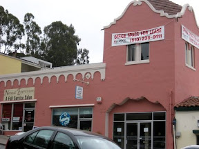
Realty Syndicate building

We walked through Montclair Village to view a building that was originally for the Realty Syndicate, the real estate and transit business owned by F.M. “Borax” Smith and Frank Havens. The headquarters of the Realty Syndicate was at 1440 Broadway, an impressive building that is still there, and currently houses Oaklandish and other businesses.

Then it was a short but steep climb up to the railroad trail. This wide, level trail follows the old Sacramento Northern Railway right of way, which makes it ideal for walking and biking—it’s part of my bike route home. My grandfather worked for the Sacramento Northern, so it has a personal connection for me as well. Along the trail there are various interpretive signs about local history installed by Eagle scout Daniel Levy.
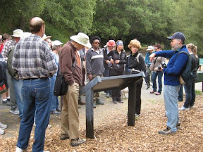
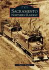
Sacramento Northern Railway display

Originally, the Sacramento Northern was primarily for passengers, but later carried mostly freight. Conspiracy theorists will be pleased to note there really was a conspiracy by GM, Firestone, Standard Oil and other companies that helped lead to the demise of electric streetcars and interurban railways around the U.S. But the Sacramento Northern also faced increasing competition from shorter, less steep railroad routes. Passenger service on this part of the route ended in 1941, the final electric train on the SN was in 1965, and the last vestiges of the SN were folded into the Union Pacific in 1983. However, this history of the Sacramento Northern and even some of the rolling stock lives on at the Western Railway Museum in Suisun.

A little further up the trail, we learned about the freeway that was never built. CalTrans bought up land in Shepherd Canyon with the plan of building highway 77. It was to be an extension of Park Blvd., and would run up the canyon and connect highway 13 with Contra Costa county (much as highway 24 does just two miles north). Fortunately, community activists argued against the plan, and the area was preserved. In 1972, assembly member Ken Meade officially protected the area with AB561. After the downfall of the freeway plan, the Shepherd Canyon Corridor Plan was shaped by volunteers, and now guides the preservation of the canyon.

stairs up to Gaspar

We doubled back and took some stairs up the hill to Gaspar Drive. Like many of the stairs in Oakland, they’re unmarked, and it’s very easy to walk past them even if you’re looking for them. We traversed our way along Gaspar and Colton and Diaz Place, a short cul-de-sac, then went down some more unmarked stairs to Cabot and then back down to Mountain Blvd.

From there, Chris took the lead, and we headed up Thornhill Drive along the upper reaches of Temescal Creek. Geographically, we’d crossed over from the Sausal Creek watershed which goes through East Oakland, to the Temescal Creek watershed which goes through Oakland and meets the bay in Emeryville. Yet another way of looking at the question of where is East Oakland?

We took a short break at a coffee shop on Thornhill. After serving the sudden flood of customers, the owner came out to learn more about the OUP walk and to greet some of the two- and four-legged participants.

steep stairs!

Then it was time for some serious stair climbing. While the stairs we’d climbed near the railroad trail were concrete, the stairs off Thornhill are mostly wood. In part because the hillside is steeper in places, and the wooden stairs can more easily match that.

Some of the stairs in this part of the walk I’d found while test-walking routes for Secret Stairs of the East Bay. We didn’t climb all the way to the top, but we pointed out an even steeper set of stairs that continued up the hill. While most of us then headed back down towards Thornhill, a few intrepid souls continued on up the stairs. That’s dedication!

All in all, another great walk. Thanks to everyone who turned out for it. Special thanks to Chris Kidd for co-leading the walk; Bob and Myra Redman for helping test the walk route; and Myra Redman and Katarina Stenstedt for taking pictures during the walk.

More pictures:

More reading:
The books mentioned during the walk are:
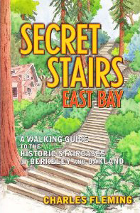
Links to more reading:

View our route on Google Maps.

OUP Walk: Jane’s Walk


Sunday, 22 people gathered for a special Oakland Urban Paths walk to honor the work of writer, activist and urban planner Jane Jacobs. The walk was the flattest OUP walk I’ve been on, with only one stairway and a gentle grade down to Lake Merritt. But it was a great walk as we hooked up with the people behind three very interesting art and history projects around Oakland, and we couldn’t have asked for better weather.

The group met in front of the mural on the Key System headquarters building on 11th Street near Broadway. Many of the stairs and paths in Oakland were built to connect people in different neighborhoods to the Key System, so it was an appropriate starting point.

10,000 Steps

10,000 Steps marker

First we heard about the 10,000 Steps project which explores Oakland’s historic parks and marks points of interest around downtown Oakland. There’s an accompanying audio tour, with interviews of different people in the neighborhoods and explanations by local historians. Artists Sue Mark and Bruce Douglas researched Oakland history, interviewed people, and spent countless hours designing and placing fifty sidewalk markers around the 5 remaining parks from the 1800s. While 2 of the original 7 parks are gone, many of the historical points of interest are still around, and the husband and wife team captured stories of people who know and lived the history of those areas.

For example, marker #26 outside the Hong Lok Senior Center in Lincoln Square reads:

Dorothy Eng’s Oak-Chi Center
blossomed Chinese daughters’ worlds
“Our soldiers had somewhere to go.”
Hospitality & Friendship
1943

If you listen to the oral history for that marker, Dorothy Eng and Beatrice Wong talk about Chinese American soldiers coming home on leave from WWII and having no place to go—they weren’t welcome at the USO. Eng, Wong and others formed the Chinese Young Women’s Society, and made their own version of the USO there. We also learned from Sue that the bricks for the Hong Lok center came from an older iteration of Oakland High School which were repurposed for the building that was used as the clubhouse.

Given the limited space for text in each 10,000 Steps marker, the text is frequently like a haiku, expressing a complex idea in a few words. Others, like the marker outside the Oakland Museum of California have one word: transform. But reflecting the history of Oakland, ‘transform’ is written in Ohlone, Spanish, English and Chinese. Although the markers are numbered, the tour is designed so that you can do all of it or part of it or just one.

Once Upon A Time, Happily Ever After

One Upon a Time…

From the OMCA, we walked the short distance past Camron-Stanford House to Lake Merritt. There we met with Scott Oliver, the lead artist of the Once Upon A Time, Happily Ever After project. The project is centered on Lake Merritt and title phrase comes from the sign outside Children’s Fairyland. It’s a three-part project: audio tour, interpretive signs, and Lake Merritt souvenirs created by local students and artists.

There are four interpretive signs around the lake. The sign between Camron-Stanford House and the Lake Chalet shows points of interest around the lake, and labels the various neighborhoods. Another sign explores the watershed, showing the depths of the lake and indicating where storm drains feed in to the lake. As part of the project, 62 markers were embedded in the walkway around the lake showing the location of the drains. Another component is Lake Merritt souvenirs created by local students and artists. Scott was sporting a t-shirt that combines drawings by different students of the iconic lampposts around the lake. That shirt and other items are available from the Once Upon A Time web store.

The third component of the project is an audio tour. The tour begins at the Rotary Nature Center. On the audio tour you’ll hear from supervising naturalist Stephanie Benevidez. She started there as an animal keeper in 1974 taking care of the center’s small zoo, which included wolves, raccoon dogs (from Oakland’s sister city, Fukuoka, Japan), porcupine, skunk, and a number of birds. These days all the live animals are outside, and Stephanie is the last full-time employee, but the mission of the nature center hasn’t changed. You’ll hear more about the goals at the second stop near the five islands that provide a safe roosting spot for hundreds of birds.

Of 21 planned stops, seven have been completed, and Scott is hoping to have the rest of the audio tour stops completed by September. At the other stops you’ll hear about the history of Lake Merritt and Oakland from a wide variety of people, as well as a wide range of music and sounds: an Ohlone song; honking Canada geese; the bells at Our Lady of Lourdes Church. (NOTE: the audio files are currently offline, but Scott is working on restoring them.)

Cleveland Cascade

Cleveland Cascade

After a brisk walk around the south end of the lake, we stopped at our final point (and #5 on the Once Upon a Time audio tour), the Cleveland Cascade. There we heard from Jim Ratliff and Barbara Newcombe of the Friends of the Cleveland Cascade about the re-discovery of the cascade and the plans to restore it. Based on photos from the 1930s, it was originally an amazing structure. Designed by landscape architect Howard Gilkey, it had 3 levels of 7 steps each. Each step had a bowl that made a curved sheet of pouring water. At each side were shell-shaped brackets, behind which were lights running through the colors of the rainbow.

By the 1950s, the cascade had fallen into disrepair. Some time after that it was buried completely. In 2004, a group worked to clean up the park which was then full of nasty stuff, as Barabra said. Jim and others worked to uncover the pools of the cascade. Since then, the park has been restored, and become one of the busiest little parks in Oakland. The Friends of the Cleveland Cascade has raised funds and replicated the bowls and shells, and are now trying to raise additional money to install plumbing and lighting and fully restore the cascade. As a step towards that, they had LED lighting installed under the handrails which helps illuminate the steps. That’s been in place for only a short while, but I’m looking forward to seeing it.

That was the end of the directed part of the tour, and people returned to our starting point by various routes. Thanks to everyone who turned out for the walk. Special thanks to Paul for leading the walk, and to Sue, Bruce, Scott, Jim and Barbara for sharing about their various projects. And thanks to Annalee Allen who publicized the event in a recent column. Sorry I couldn’t make it to your Jane’s Walk in the afternoon!

More pictures from our walk:

Related links:

All the walkers we saw with CEID t-shirts were part of a walk-a-thon for the Center for Early Intervention on Deafness.

Our route in Google Maps:

View Oakland Urban Paths: 2012 Jane’s Walk in a larger map

OUP Walk: Laurel to the Redwoods

Last Saturday 50 people joined Oakland Urban Paths for a walk, Laurel to the Redwoods. The large turnout was due in part to people coming to hear our guide for the walk, Dennis Evanosky, a local historian and writer who is extremely knowledgeable about Oakland and East Bay history.

We started the walk at Saint Lawrence O’Toole Catholic Church in the Laurel. The church was originally closer to where I-580 is now, but before the freeway came through, the church moved up the hill to its current location. Then we walked a short distance to Scheberies Used Cars for the first of our urban paths. While Dennis told us about MacArthur Boulevard and the freeway, Gerry Scheberies came over to the edge of the lot. He’s been part of Oakland for a long time—since before the I-580 freeway was built. MacArthur Blvd. was part of a national plan for a road, intended to go from Mexico to Canada, but only the Oakland segment was built. See pictures and info from my visit 1.5 years ago.

We took a number of urban paths and more traditional sidewalks through the Upper Laurel neighborhood into Redwood Heights, both of which are full of lovely homes. Then it was a big uphill on Carson Street to George E. McCrea Memorial Park, home to the Oakland Casting Club. That’s right, Oakland has casting ponds for people to practice their fly casting. The park also has trout ponds, but those are no longer used.

Then it was over highway 13 to Leona Heights, once site of the Laundry Farm Hotel. Named for the laundry operations that once filled the area, someone doubtless recognized that a name like Leona Heights Hotel would have more appeal, and the hotel was renamed. The original plan for the OUP hike was to go up the York Trail near Horseshoe Creek, but the heavy rains we got a while back had damaged the trail and bridges, so we just viewed the area from trailhead and heard about the redwoods.

Nearby we saw part of a quarry operation. What’s left is an odd concrete tube, which rock was pushed down (later they used railed carts) and delivered to a crusher. That rock was used for railroads, including the Feather River Canyon.

Up another nearby canyon took us to an abandoned sulfur mine. The original miners were excited because they thought they’d found gold, but it turned out to be iron pyrite (fool’s gold). But they soon discovered that the sulfur deposits there could be profitably mined instead.

We went up the nearby fire trail a ways, where we could see the old Chabot Observatory below. That was actually the second Chabot Observatory; the original was on 11th and Jefferson in Old Oakland and dated back to 1883. They moved to the Mountain Boulevard location in 1915 because of light pollution, but access to that became limited in 1977 because of seismic safety concerns. The current facility, the Chabot Space and Science Center along Skyline, opened in 2000. Further up the trail we saw the approximate location where one of the first maps of the Bay Area was drawn.

We walked back through the triangle between highway 13 and I-580, and saw Montgomery House, a home which was built by the Montgomery family for missionaries to stay in while they prepared to ship out on their mission trips. There’s a small chapel on the grounds which is still in use, and we were told the house across the street was one of the earliest orphanages in Oakland.

We worked our way back to our starting point, and I at least was definitely tired—as advertised, this was a strenuous walk. Thanks to Dennis Evanosky and Paul Rosenbloom for leading us on the walk, and thanks to all who joined us. The OUP walk coming up in May will definitely be less strenuous.

More info:

Lots more pictures from our walk:

See our route on Google Maps.