OUP walk: Montclair and the Sacramento Northern Railway


On Saturday, there was a nice turnout for the Oakland Urban Paths walk exploring Montclair and the history of the Sacramento Northern Railway. About 50 people and 3 dogs joined us for a hilly walk with several sets of stairs.

Links to the websites I mentioned:
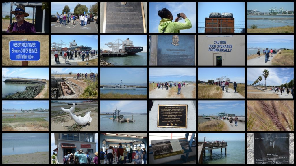
We started in Montclair Park near the duck pond, which dates back to the days of the J. H. Medau Dairy. A short distance away was our first stop, the 1927 storybook Montclair Firehouse. It was not designed by noted architect Julia Morgan, but Eldred E. Edwards of the Oakland Public Works Department. Because of seismic issues (the Hayward Fault is nearby), accessibility, and other problems, it has stood empty since 1989.

At the corner of Thornhill and Moraga, we talked about the Sacramento Northern Railway. It started as two railroads, the Oakland, Antioch and Eastern which ran from Oakland to Sacramento, and the Northern Electric Railway that ran from Sacramento to Chico. The railroad connected with the Key System and used their tracks beyond 40th and Shafter, and for a time, even crossed the Bay Bridge.

Around the block onto Fernwood, we came to the former location of the Fernwood estate. It was first the country estate of Legendary Local of Oakland, Jack Coffee Hays. The area was referred to as Hays Canyon or Jack Hays Canyon for many years. After he died, his wife sold the property to William Dingee, of Oakland Water Company fame. Dingee built an opulent 19-room Queen-Anne style mansion, and had additional landscaping done with gardens, terraces and waterfalls. He also added such features as a deer park and an elk paddock. Unfortunately the home (and lots of artwork inside it) were destroyed in an 1899 fire. The land was then sold to the Realty Syndicate.

After a quick stop at the Montclair Women’s Club and the storybook Montclair Library (also not designed by Julia Morgan), we headed up our first set of stairs to Cabot Dr. Down Cabot and up Mountain Blvd. took us to another set of stairs up to Magellan Drive. The stairs continue up to Gaspar Drive near Snake Road, but we headed down to the Montclair Railroad Trail.

There we talked more about the Sacramento Northern, and about Highway 77, a highway that was planned but fortunately not built. It would have gone up Shepherd Canyon and through to Moraga; on the other side of Highway 13, it would have followed Park Blvd. and 14th Avenue over to I-880 (then Highway 17). People fought against the freeway plan, and with work by California assembly member Ken Meade, the plans were changed.

A walk through the parking garage(!) to see some murals, then past more murals on the drugstore and the yogurt store we came back to Moraga Avenue. Given the warm day, some people opted to head back to the start, but some intrepid souls joined me for one last hill and stairway. Across Highway 13 and then down Bruns Court took us to a pedestrian bridge which crosses both the highway and Moraga Avenue, to return us to our starting point.

Thanks to everyone who came out for the walk, thanks to our volunteer speaker carrier, and special thanks to Charlie for once again bringing up the rear to make sure we didn’t lose anyone. Hope to see you on the paths!

IMG_1277

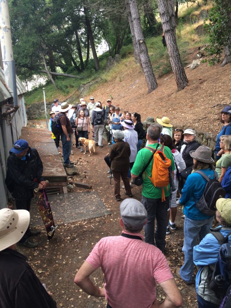
photo courtesy Jennifer Anderson

OUP walk: Sibley Volcanic Regional Preserve


On Saturday, local historian and author Dennis Evanosky led Oakland Urban Paths on a hike through Sibley Regional Volcanic Preserve. It was quite a bit less urban than our regular walks; there were no stairs, no streets to cross, and instead of worrying about traffic, our biggest concerns were poison oak and cow pies.

Dennis told us some about the geology of the area. The peak, Round Top, is an ancient volcano. It sits between two faults, the Hayward Fault to the west, and the Calaveras Fault to the east. Over time, the volcano was tipped on its side. Much of this wouldn’t be visible, except Kaiser Sand and Gravel quarried in the area for basalt, and resulting digs exposed more of the underlying geology.

At the bottom of several former quarries, labyrinths have been constructed. Unlike mazes, which have any number of false routes and dead ends, a labyrinth has a single path from the outside to the center. The size is usually measured by the number of turns, i.e., how many times the path doubles back. Walking a labyrinth can be an act of meditation; I would guess constructing one could be, too.

Along with geology, there were lots of wildflowers to look at, and a variety of birds, including crows, a red-tailed hawk, and in the distance, a turkey.

Our final stop gave us a view of another ancient volcano, Vollmer Peak (formerly known as Bald Peak) in Berkeley, the Caldecott Tunnel, and the site of the eastern end of the former Kennedy Tunnel. A great hike—many thanks to Dennis for leading it, and to the 45 or so folks who came out to participate.

The next regular OUP walk will be Saturday, June 11th, but we haven’t decided which walk we’ll do. On Saturday, June 4th, there will be a special walk in the Golden Gate neighborhood as part of Love Our Neighborhood Day. Note the different start time.

More photos from the hike:

2016 Women’s History walk

at Camron-Stanford House
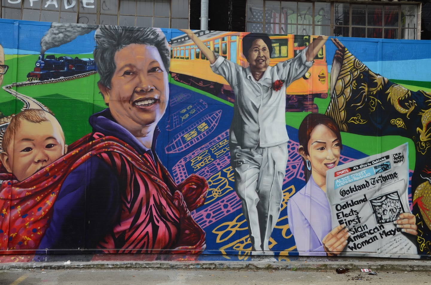
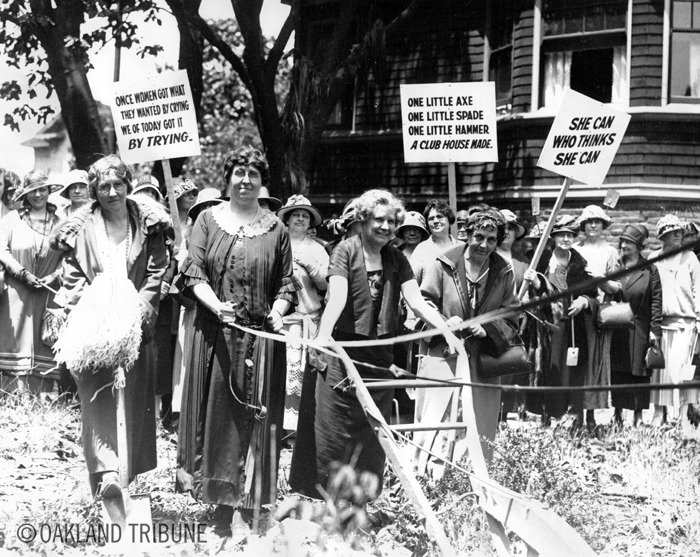
On Saturday, we had a great turnout for the 3rd annual Women’s History walk, with more than 50 people of all ages turning out to learn about some of the remarkable women in Oakland’s history. As Annalee Allen and I warned at the start, there are too many notable women to talk about, but we covered as many as we could with as much information as we could.

A map of our route and some of the other points of interest is here, and more photos from the walk can be viewed here. The places we stopped and the women we talked about are listed below. Note that most of these are links to oaklandwiki.org where you find more information and images about the person or place.

Camron-Stanford House
Oakland Women's Rowing Club

Main Library + Playgrounds

Alice St. MuralOakland Women’s City Club (1927)
part of Alice St. mural

Hotel Oakland (1912)

Oakland Business and Professional Women’s Club
groundbreaking for Business and Professional Women's Club

YWCA

Kahn’s Department Store

City Hall and Jack London Oak
Wilhelmine Yoakum

14th and Clay

City Center
Delilah Beasley

Tribune Tower

Joyce Gordon Gallery

Joyce Gordon Gallery Niambi Kee and 'Oaktown Blues'

OUP walk: Cleveland Heights and “Borax” Smith


On Saturday we had an overwhelming turnout for the Oakland Urban Paths walk focused on the Cleveland Heights neighborhood and the nearby former home of “Borax” Smith. A record 132 people enjoyed the unseasonably warm weather to learn about this part of Oakland.

We started at the Cleveland Cascade, a water feature on the shores of Lake Merritt, built in 1923. It fell into disrepair, but a group of neighbors has cleaned it up and is raising money to restore it. Keeping our eyes out for gnomes, we wound our way around to the middle of the Haddon Hill neighborhood. It started as an exclusive development in 1912 by Wickham Havens, son of Frank C. Havens.

We had a longer stop at 552 Montclair Avenue. This c.1897 Victorian was built for Judge Edward C. Robinson and his family, including son Bestor Robinson who was law partners with Earl Warren and led the Sierra Club for many years. The house has lots its “witches hat” and been divided into apartments, and the tankhouse has lost its tank and windmill, but it’s still a spectacular property.

Our path took us past the Park Community Garden (the artwork I mentioned, “Her Resilience”, has been moved indoors for the rainy season) and a couple of murals, including one by Peter Lee. After walking past several beautiful apartment buildings that date back to the 1920s and 1930s, we stopped to talk about “Borax” Smith.

Francis Marion Smith, known as Frank to his friends, and to his consternation, “Borax” Smith to the rest of the world, was a legendary local of Oakland. After making a fortune in borax (used as a cleanser), he invested in Oakland. He was the force behind the creation of the Key System street cars; the Realty Syndicate (where he partnered with Frank C. Havens) developed areas of Oakland and built the Claremont Hotel. His estate was called Arbor Villa; the row of tall palm trees on 9th Avenue marked one edge of the estate. While the grounds and the magnificent Oak Hall were being constructed, Frank and his wife Mary moved into the “old red house” (currently painted green) nearby. The Smiths entertained and hosted fundraising events in a grand style: “The most brilliant affair of the week of course was the reception which Mr. and Mrs. F. M. Smith gave on Wednesday evening at their charming home, Arbor Villa, in East Oakland, to which over 1300 guests from both sides of the bay were bidden.” (April 23, 1899 San Francisco Call).

Mary R. Smith was inspired by reading Benjamin Farjeon’s Blade O’ Grass about orphans in London, and the Smiths took in a number of young girls. Frank gave her some land nearby, and they set up a trust. The Mary Smith Home for Friendless Girls became home to numerous orphaned girls. The girls lived in cottages, each run by a house mother; the older girls helped take of the younger girls. Many of the cottages, including one designed by Julia Morgan, still stand.

Our final big stop was across from the Haddon Hill home of industrialist Henry J. Kaiser. We also looked at some former steps that used to go from the end of Haddon Rd. down to MacArthur Blvd. Those are closed off, and the statue that graced the plinth is long gone.

Thanks to everyone who came out for the walk! The regular second Saturday walk for March 12th hasn’t been set yet, but there will be a special walk on Saturday, March 19th, focused on women’s history. Check the website calendar for more info, and hope to see you on the paths!


More photos from the walk here.

OUP walk: Brooklyn


On Saturday, about 70 people and 5 dogs joined Oakland Urban Paths for a walk exploring the former town of Brooklyn, east of Lake Merritt. There were overcast skies, but we managed to get a break in the (much-needed) rain. Last year local historian Robert Perricone led this walk for OUP, but we changed things up a little this year.

The town of Brooklyn was formed in 1856 by the merger of two smaller settlements, Clinton and San Antonio, and later annexed the town of Lynn just to the north. It was named for the ship Brooklyn which brought Mormon settlers to California in 1846. County supervisor Thomas Eagar suggested the name; he’d been a passenger on the Brooklyn. The town didn’t last too long; in 1872, voters approved annexation by Oakland. But it’s worth noting that most all of what is now Oakland that wasn’t already part of Oakland or the town of Brooklyn was called Brooklyn Township, so an older location name might refer to either.

Next to Clinton Square Park where we met had been the home of Hiram Tubbs, who made his fortune in making rope, and was one of the founders of Mountain View Cemetery. A house built for one of his daughters and son-in-law, the Tubbs-Henshaw House, still stands across International Blvd. Locally, Tubbs was best known for building the palatial Tubbs Hotel, which filled the next block over. Gertrude Stein lived there with her family when they first moved to Oakland. Writer Robert Louis Stevenson stayed there. “Borax” Smith met his first wife Mary at a dance at the Tubbs Hotel (February’s walk will be about Cleveland Heights and the former Borax Smith estate.) Unfortunately, the building burned in 1893. The fire department didn’t have enough water to fight the huge fire, so all they could do was join the crowd of onlookers and watch the spectacle.

Stein left Oakland in 1891 after her parents died, and didn’t return until 1935. During that time, the Tubbs Hotel burned down, the family house was torn down, Oakland’s population increased from 35,000 to nearly 300,000, and the bucolic neighborhood where the family had lived was now full of apartment buildings and nearby Highland Hospital. The Oakland of her childhood was gone, and you can’t go home again—that’s what she meant by “there’s no there there”.

We stopped and talked about lots of places, some dating back to when it was the town of Brooklyn, and some more recent. One place where we all learned something new as the Vue du Lac Apartments at the corner of Foothill and 3rd Avenue. The building was constructed in 1906 by Charles MacGregor, known as “the builder of Albany” where he constructed about 1,500 homes over the years. He was also called “One-Nail MacGregor”, either in a jab at his being overly thrifty, or (more likely) a compliment at the quality of his buildings.

At the Ellen Kenna House, a spectacular Victorian that Ellen Kenna had built in 1888, there were questions about the front door, or more to the point, what appeared to be the lack of one. According to the current owner, “Ellen Kenna owned the block from 12th to 13th Ave. The Valentine Mansion across the street was also situated with its front facing 13th. After Ellen died and it became a hospital, several small homes were built for the staff on the 13th Avenue side (the front). These, too, were eventually subdivided and the stairs coming from the front were awkwardly redirected towards East 21st Street.” Alas, he has to sell the home, so while tons of restoration work have restored much of the former glory of the home, he won’t have time for the rest of the changes.

Thanks to volunteer Charlie Lenk for helping with the walk, and thank you to him, John Rengstoff and Ed Matney for the use of some of their photos:

Some of the other points of interest and people we talked about include:
Brooklyn
Clinton
Hiram Tubbs
Tubbs Hotel
Tubbs-Henshaw House
Mountain View Cemetery
Intertribal Friendship House
First Swedish Baptist Church
Vue du Lac Apartments
Asa White House
Our Savior Danish Lutheran Church
1819 – 7th Avenue
Tower House
James Presho House
Harbor House Ministries
Clinton Shrine
Quan Am Tu Shrine
Ellen Kenna House
Mother’s Cookies
Sunset Telephone Company
St. James Episcopal Church
Brooklyn Presbyterian Church
Brooklyn Firehouse
Fowler Block
Random Parts mural
Olander’s Saloon
Brooklyn Basin project
East Oakland Brewing Company
Brooklyn Brewery
Palm Trees
Oakland Gnomes
(And something we don’t have an Oakland Wiki page on, the TARDIS, which was seen on a nearby roof.)

There’s even more in the area, which we didn’t have time to cover, or which only got a brief mention:
Elizabeth Flood
Brooklyn Colored School
Williams Block
John A. Wilds
En El Libro Tu Libertad Mural
Malaquias Montoya
Plaza Theater Teatro
Central Block
Dr. William Bamford House
David Carrick House
Asa Howard House
Palm Terrace
Captain Henry E. Nichols House

Get out and explore on your own! You can also join us on Saturday, January 23rd, for a special walk about author Jack London. Our regular walk on February, 13th, will focus on Cleveland Heights and the former “Borax” Smith estate in Ivy Hill.

OUP walk: Legendary Locals of Oakland

Saturday we had perfect weather for an Oakland Urban Paths walk focused on some of the people in my new book, Legendary Locals of Oakland. The book has profiles and images of 180 of the people who have shaped Oakland over the years, both historic and contemporary. About 70 people and 6 dogs joined us to explore Lakeside Park and Adams Point, and learn about a few of the people in the book.

We started near the Rotary Nature Center where I talked about Lake Merritt being the oldest wildlife refuge in the country, dating back to 1870, even before the National Park System. To protect birds, neighbors, and property values, Dr. Samuel Merritt lobbied California governor Henry H. Haight to make the area surrounding the lake into a wildlife refuge. Nearly 80 years later, Paul Covel was hired to be the first municipal naturalist in the country, who taught countless children I also talked a bit about current naturalist, Stephanie Benavidez, who’s not in the book but is a legendary local, too.

I also talked about mayor Melvin Chapman and Oakland founding scoundrel Edson Adams (along with Horace Carpentier and Andrew Moon). In the Gardens at Lake Merritt, we talked about WWII internee Frank Ogawa, namesake of the garden center Marsha Jean Corprew, world-renowned music producer Harold Lawrence, and Calvin Simmons, the first black conductor of the Oakland Symphony Orchestra. We could see the bandstand across the way, and I talked about Fred Morcom, mayor of Oakland and namesake of the Morcom Rose Garden,

At nearby Children’s Fairyland, there were a lot of people to talk about: Oakland Parks superintendent William Penn Mott, Jr., puppeteer Frank Oz and master puppeteer Lewis Mahlmann (both pictured above with Oz’s character, Bert of “Sesame Street”), restaurateur and inventor of the mai tai “Trader Vic” Bergeron, and businessman Joe Shoong.

Near Lake Merritt I talked about then-mayor Jerry Brown and the story of Measure DD that brought about the improvements to the lake, and about industrialist and healthcare creator Henry J. Kaiser. Over on Webster, I told people Sid Hoff and the Ali Baba Ballroom, and 3-time restaurateur James Syhabout of Hawker Fare, The Dock at Linden Street, and the Michelin-starred Commis.

Over on Broadway, we stopped in front of The Hive. There I talked about legendary newspaperman Robert Maynard and his wife Nancy, one-time owners of the Oakland Tribune. One of the buildings that makes up The Hive is a former automotive business designed by Oakland architect Julia Morgan, better known for designing Hearst Castle. Someone asked about the church that had been where the YMCA building across the street now stands; that was the First Methodist Church, which was destroyed by a spectacular fire in 1981.

At 27th Street we stopped between the First Presbyterian Church and Temple Sinai. Connected with the former are Henry Durant one of the founders of the University of California, and Laurentine Hamilton, who was charged with heresy and left (along with much of the congregation) to form what became the First Unitarian Church. Members of Temple Sinai include writer and art patron Gertrude Stein, of the infamous but misunderstood “there is no there there”, and Rachel “Ray” Frank, the “girl rabbi of the Golden West”, whose students included a young Gertrude Stein.

Walking up 28th Street we climbed our first set of stairs to Hamilton Place. Down Harrison took us to the First Congregation Church. Notable members included “Borax” Smith, borax miner and creator of the Key System, and his first wife, Mary R. Smith, who started an orphanage for girls. (The walk in February will focus on Cleveland Heights and “Borax” Smith.)

Across Harrison we climbed another set of steps to Vernon Terrace and Vernon Street. There we saw the home of judge and Chief Justice Earl Warren. He was head of the U.S. Supreme Court that ruled on the historic Brown v. Board of Education which banned segregation in public schools. As California District Attorney, Warren had been”the moving force” behind the WWII internment of Japanese Americans, but he later said he deeply regretted that.

The next streets we went past included Adams Street, named for Edson Adams, and Jayne Avenue, named for his wife, Hannah Jayne. She was Oakland’s first, and for a time, only teacher. I talked briefly about Alice Street downtown, named for the sister of Horace Carpentier, Alice Carpentier.

With a large group on the walk and so many people to talk about, we didn’t have time to go over to MacArthur Blvd., but instead we walked to the back side of Temple Beth Abraham. It’s named for Abraham Bercovich. His brother Edward Bercovich and later his nephew Sam Bercovich ran a furniture business, and supported youth athletics in the East Bay. Many of the athletes went on to college and pro careers, including baseball player Curt Flood. His refusal to be traded by the St. Louis Cardinals led to free agency in sports.

Our last stop was at the home of Rose and Joe Shoong, founder of National Dollar Stores. To keep the connections going, the home was designed by none other than Julia Morgan.

A great walk—thanks to everyone who came out for it, and to everyone who bought a book! Special thanks to Alan Forkosh and Paul Rosenbloom for the use of some their photos, thanks to whoever carried the speaker, and thanks to volunteer Charlie Lenk for helping with all sorts of stuff. More pictures from the walk:

OUP walk: Water and Change


Nearly 100 people (plus a record 8 dogs) turned out for the Oakland Urban Paths walk exploring the changes along the estuary and the Lake Merritt channel. Led by city planner and WOBO member Ruth Miller, we started in front of the historic Heinold’s First and Last Chance Saloon.

We began by viewing some historical maps of Oakland that help show just how much we’ve changed the shoreline of Oakland over the years. The 1857 map in particular shows clearly that Lake Merritt isn’t a lake, but a tidal slough, and much of West Oakland is filled land. (You may also notice that much of Alameda is fill, and that it wasn’t originally an island.)

Ruth told us some about Measure DD, a 2002 bond measure that has paid for numerous improvements around Lake Merritt and the estuary. Part of that is to improve the flow of water in and out of Lake Merritt. While the channel won’t be as wide as it was in 1857, it is being widened and made more friendly to wildlife and people. We crossed over the channel on the bridge at Embarcadero. Like the other bridges across the channel, this one is slated for replacement, too. The new bridge will be wider and include bike lanes and proper sidewalks, and should provide better clearance for kayaks and other small boats.

Then we went in to the 5th Avenue Marina, a small community of artists in the middle of an otherwise industrial area. They’ll be getting some neighbors in the form of the $1.5 billion Brooklyn Basin project, but not all of them are very happy about it. All around them will be shiny new buildings, a mixture of residential and retail, some as tall as 22 stories. The neighborhood will still exist, but how will it be changed?

We then walked up the channel a ways and over one of the pedestrian bridges back to the other side in the midst of the Laney College campus. Ruth told us about more of the Measure DD work, first mayor of Oakland Horace Carpentier and his ‘bridge of sighs’, and the pottery studio at Laney. From there we followed the channel to 7th Street. We were going to go under the street, next to the 7th Street pumping station, but ironically the walkway was too flooded. The pumping station was built in 1971 because of flooding around Lake Merritt in the 1960s. Now they mostly let the water flow in and out with the tide, but if a big storm is forecast during a high tide, they can bring down the lake level to make room, and even pump against the tide if they need to.

More meandering took us to Victory Court, near the Oakland Fire Department’s training center. I told people about what had been there before. It’s filled land, but before Laney College was there, it was Frank Youell Field, where the Oakland Raiders played from 1962 through 1965 while the Oakland Coliseum was built. (And did you know the Raiders were almost called the Oakland Señors? It was the winner of a naming contest, but fortunately didn’t go through.) And before the football field was the Auditorium Village Housing Project, “temporary” housing built for some of the many people who came to work in the Bay Area shipyards during WWII. That’s where Victory Court got its name. (The WWII housing project in West Oakland that someone asked about was the Harbor Homes Housing Project.)

A few people returned to Heinold’s for more talk and a post-walk beer (though Heinold’s didn’t open until close to 1PM, instead of 12-ish). Another great walk! Thanks to everyone who came out, and special thanks to Ruth Miller for guiding us on the walk. The location of next month’s walk is to be determined, but it will be the 2nd Saturday, December 12th at 10AM.

More pictures from the walk. Thanks to volunteer Charlie Lenk and walk participant Ethan Lavine for the use of some of their photos.

OUP walk: Three Jellyfish, Two Creeks and One New Book


On every Oakland Urban Paths walk, we try to include some history, art, current events, and to hook up with people in the neighborhood whenever we can. On last Saturday’s walk, “Three Jellyfish, Two Creeks, One New Book”, we had all that and more. About 80 people joined us for an exploration of the Fruitvale district, led by OUP co-founder Paul Rosenbloom.

We started the walk at the Peralta Hacienda Historical Park. While the centerpiece is the home that Antonio Maria Peralta lived in with his family, Peralta Hacienda covers local history from the days of the Ohlone people to the present day and regularly hosts cultural events. It’s also part of the Juan Bautista de Anza National Historic Trail, a unit of the National Park Service.

We crossed the first of the two creeks, Peralta Creek, then headed down 35th Avenue to the Calvin Simmons Middle School. There Paul told us a bit about Oakland Symphony Orchestra director Calvin Simmons, who died tragically young just a few years into a promising career.

Across 35th and up Galindo Street, we came to the 3 jellyfish, part of a new art installation on the Carrington Steps. A few years ago, the steps were a dumping ground and an eyesore. The neighbors got together and cleaned them up, got a grant and created a beautiful mosaic, and got another grant and had Oakland muralist Dan Fontes create a colorful and unique staircase mural. Fontes is probably best known for murals around Oakland like the Giraphics murals under I-580. We heard from Fontes and Cynthia Elliot of Keep Oakland Beautiful about the whole process. Now local students and their parents happily use the stairway, and so far, the stairs are staying clean. (For whoever was wondering, the school beyond the top of the stairs is the Global Family Elementary School.)

Continuing our walk took us along part of Foothill Blvd., where we could see some of the results of the Fruitvale Alive! Community Transportation Plan that was completed in 2005. The streetscaping includes stamped intersections, colorful wayfinding signs, and more. Then it was on to the first of two city parks, the recently revamped Cesar Chavez Park, which includes a stretch of Peralta Creek. We walked near St. Elizabeth Church which was originally organized by German Catholics, but now the congregation is mostly Latino. Crossing Fruitvale Avenue took us to the next city park, Josie de la Cruz Park, named for a local community activist and home to the Carmen Flores Recreation Center. There we got our first glimpse of our second creek, Sausal Creek.

Then it was on the new book portion of our walk. We were a bit surprised to enter Austin Square Park along Sausal Creek by a different entrance than when we’d scouted the route before. We were quite surprised to find the approach required climbing down the hillside to the creek with the aid of a rope. But there we got to hear about the new bilingual children’s book, I Am Sausal Creek / Soy El Arroyo Sausal. We heard from the publisher, Josh Fowler of Nomadic Press, book illustrator Robert Trujillo, and author Melissa Reyes. When she was a teacher, she was told to teach Oakland history to young students, but found few age-appropriate resources, and the idea for the book was born. Reyes read from the book, which tells the story of Sausal Creek from the days of the Ohlone up to present times. It’s full of beautiful watercolor illustrations by Trujillo, and also has a section for parents and older children with a bit more detail about the history.

All around a great walk! Thanks to everyone who came out for the walk, to Paul for organizing and leading the walk, and new OUP volunteer Charlie for helping with the walk logistics. And thanks to Charlie, Noël and Tom for the photos. Be sure to check out Tom’s video at the end of this post.

Next month’s walk will be a more strenuous hike, from the Dimond district up to Skyline Blvd. with a return by bus. See more info here.

Some other notes: the 20th annual Creek to Bay Day is this Saturday, September 19th. This is a fun, free, family-friendly way to help make Oakland more beautiful and protect our local environment. There are work projects along Sausal Creek, Peralta Creek, and all the other creeks that flow through Oakland to the bay. Find a project near you and see more info here.

Sunday, September 20th is the 3rd annual Love Our Lake Day. Some of the streets around Lake Merritt will be closed to vehicle traffic, so people can walk, run, cycle and dance in the streets with a variety of events. I’ll be leading a special walk at Lake Merritt — see more info here.

Speaking of the creeks, check out the Guide to San Francisco Bay Area Creeks on the Oakland Museum of California website. There’s online info and a printed version of the map, too.

More pictures from the walk:


To make sure we had enough time for the book event, we skipped part of our route that included seeing the Cohen-Bray House. The home was built by Julia Moses and Watson A. Bray as a wedding present for their daughter Emma, who married attorney Alfred H. Cohen on February 28, 1884. The sprawling Bray family estate was across the street, and while it’s gone, the Cohen-Bray House is an elegant reminder of times past. Tours are available by appointment.

We also didn’t have time to talk about Patten University near Peralta Hacienda. It was founded by evangelical Dr. Bebe H. Patten as the Oakland Bible Institute, after the Pattens led a revival at the Oakland Auditorium that went on for 19 weeks and had as many as 5,000 people a night.

OUP walk: Glen Echo Creek


Saturday, 35 people (and one dog) joined Oakland Urban Paths for an exploration of the Glen Echo Creek watershed, led by Chris Kidd.

The local topography is something like a hand with the fingers spread, with ridge lines alternating with shallow valleys cut by streams like Glen Echo Creek. The creek starts as two branches, Cemetery Creek that comes through Mountain View Cemetery, and the Rockridge branch, which comes through the Claremont Country Club’s golf course and feeds into the Bilger quarry. Heading east from our start outside the Cat Town Cafe and Adoption Center, we descended slightly then began climbing the next ‘finger’ on the other side.

There are lots of beautiful houses and stairways along the way. One interesting stop was at Oak Park. The site was formerly Edison Elementary School which one person on the walk had attended as a child. The school was closed in 1971 because it wasn’t up to earthquake standards. It was subsequently sold and converted into condominiums. While the playground became a city park, the city doesn’t maintain it, the neighbors do.

Like many creeks in the East Bay, much of Glen Echo Creek runs in underground culverts. Glen Echo does have more open segments than many creeks, but it almost disappeared completely. Back in the 1950s, there was a plan to build the Richmond Blvd. Freeway which would have run from near Snow Park downtown, over Glen Echo Creek and through Piedmont, and to highway 13. Fortunately it wasn’t built…the freeways that were built were hard enough on Oakland as it is.

We meandered through part of Piedmont and to the Morcom Rose Garden. It was created in originally called the Oakland Municipal Rose Garden and the first rose was planted by then-mayor Fred Morcom in 1933. We took a brief break there while people checked out the roses, watched the labors of the Dedicated Deadheaders who take care of the roses, and looked at the names on the Oakland Mother of the Year walk of fame.

A different route took us back to our starting point, a bit tired but a lot more knowledgeable. Thanks to everyone who came out for the walk, and thanks to Chris for leading it!

Next month’s walk is still being worked out, but check www.oaklandurbanpaths.org for details. As usual, it will be the 2nd Saturday, starting at 10AM. See you on the paths!

A map of our route (PDF).

More pictures from the walk: